Size Guide

In stock
National Geographic
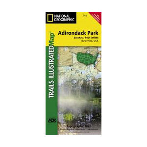
National Geographic - Saranac/Paul Smiths Map
National Geographic - Saranac/Paul Smiths Map
Regular price
$14.95 USD
Regular price
$14.95 USD
Sale price
$14.95 USD
Unit price
per
SKU:53017
Couldn't load pickup availability
- Free Shipping on Orders over $69
- Fast and Easy 90-Day Returns
- Best Price Guarantee
This Trails Illustrated topographic map is the most comprehensive and complete recreational map for the Saranac and Paul Smith area of Adirondack State Park in New York. The map shows all trails, campsites, and recreational features, plus relevant information on wildlife, history, geology, and archaeology.
Features
Features
- Coverage includes McKenzie Mountain and Sentinel Range Wilderness Areas; Raquette Boreal, Whitehill, Saranac Lakes, Debar Mountain and Taylor Pond Wild Forests; Saint Regis Canoe Area; Saint Regis Falls, Lyon Mountain, and Au Sable Forks.