

Low stock| New gear?Brand new, factory fresh gear.
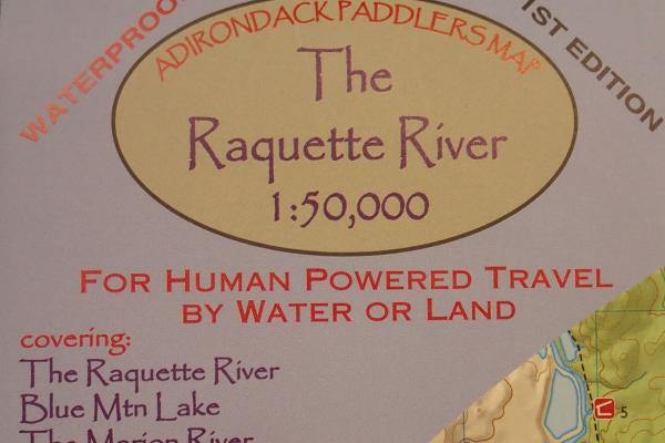
Raquette River Paddlers Map
Raquette River Paddlers Map
SKU:DK83X
Couldn't load pickup availability

Collect 10 points with OGE Rewards


Overview
Waterproof and tear-resistant material. Full color, shaded relief and topographic map at a 1:50,000 scale; 18X24" format folded to approximately 4x9". Shows private land, state land, and wilderness designated lands, in different colors. Mountains shown in shaded relief in addition to topographic lines—map is metric. Up to date portages, trails and numbered campsites. UTM Grids.
Features
- Raquette River
- Blue Mountain Lake
- The Marion River
- Long Lake
- Tupper Lake
- Raquette Lake
Shipping policy
FREE Standard Shipping on Orders Over $99
Orders will be shipped using the most appropriate standard economy method for their size and destination.
Some restrictions apply:
- Oversized items (bikes, crash pads, large sleds, car racks and cargo boxes, etc.) do not qualify for free shipping, but skis and snowboards do!
- Orders shipped to Alaska, Hawaii, Puerto Rico, or any other US territory outside of the lower 48 states (including APO/FPO addresses) do not qualify for free shipping.
- Drop-shipped items: Some of the gear we sell is drop-shipped from off-site warehouses and does not qualify for our $99 free shipping threshold. At checkout, the shipping cost for these items will be calculated separately from the items shipping from OGE's warehouse.
Our Current Dropship Brands:
- Knockaround
- Crystal Creek Gear
- Shinesty
- The Gravity Cartel (SPANK)
- Featherstone Outdoor
- Tenkara USA
- Klean Kanteen
- Type2 Gear
- Kyrgies
- Gravity Grabber
- Jetty (Online-only items)
- UCOgear
- Outdoor Tech
- Stone Creek Outfitters
- Saola USA
- Hootie Hoo
- Pirani Life
- Grand Trunk (Online-only items)
- VOORMI
- Flipfuel.co
Shipping Options
| Service | Approximate Delivery Time* |
|---|---|
| Free Shipping on orders over $99 |
4 - 8 business days |
| UPS Ground | 1 - 6 business days (see delivery zone maps below) |
| USPS Priority | 1 - 3 business days |
| FedEx Ground | 1 - 6 business days |
| FedEx Home Delivery | 1 - 6 business days (with Saturday deliveries) |
| Service | Guaranteed Delivery Time* |
|---|---|
| UPS Three Day Select | 3 business days |
| UPS Second Day Air | 2 business days |
| FedEx 2-day | 2 business days |
| UPS Next Day Air Saver | Next business day** (typically by 3pm) |
| UPS Next Day Air | Next business day** (typically by 10:30am) |
*Not including order processing time prior to shipment.
**UPS Next Day Air services do not include Saturday or Sunday delivery. Please contact us if you need Saturday delivery.
Delivery Zone Maps
UPS Ground Delivery Zone Map

FedEx Ground/Home Delivery Zone Map

OGE Shipping Guidelines
Daily Shipping Cutoff Time
Orders placed after 2pm Eastern Standard Time (EST) will not ship until the following business day. Orders shipping UPS or FedEx received after 2pm EST on Friday will ship the following Monday at 5pm EST, including expedited orders.
Please give us a call at 888-547-4327 with any questions about shipping times associated with expedited or standard delivery.
Ski Mounting Will Affect Shipping Times
Applying our ski mounting service to an order of skis and bindings will result in the addition of 5-7 business days to your shipping time.
Shipping Rate & Carrier Information
Our shipping rates are determined by your location, the product's weight, and the size of the product. We will default to the most economical carrier option to ship your order. We also offer expedited UPS and Fedex options along with non-expedited USPS options. UPS is our preferred carrier because they provide better insurance and tracking services.
Please note that all shipping times listed above (including expedited service) are in business days only. Saturdays, Sundays, and holidays are excluded.
Next Day Air pricing does not include Saturday delivery fees. If your Next Day Air shipment is expected on a Saturday please call for pricing.
Shipping to APO/FPO Addresses
We are able to ship orders to APO/FPO addresses via the United States Postal Service (USPS).
The estimated delivery times that appear on this page do not apply to orders being shipped to APO/FPO addresses.
Wrong Address and Refused Package Policy
A complete and accurate shipping address is required for all shipments. Outdoor Gear Exchange does not refund freight charges on packages that are returned to us as undeliverable.
Any freight charges assessed by the shipper for returning a refused package will be the customer's responsibility. If these charges are less than the value of your return we will deduct that amount from your refund.
Multiple Shipments
While Outdoor Gear Exchange attempts to ship orders together and complete, we may ship multiple items separately. Don't worry, you won't be charged any additional freight for it.
Shipping of Restricted Items
Products containing compressed gases, or otherwise meeting the definition of regulated materials (ORM-D), must be shipped via ground methods, and cannot be shipped to Alaska or Hawaii.
Order Verification Policy
All orders are subject to approval and verification. If the shipping and billing addresses on your order are different, additional verification will be required which may cause delays. If there are any issues fulfilling or shipping your order, Outdoor Gear Exchange will contact you by phone or email.
If you have ordered multiple items and there is an issue with part of your order, we will ship the partial order if we do not hear back from you concerning the order within 72 hours to avoid any further delays.
Bike Shipping Policy
Shipping New Bikes
New bikes purchased from Outdoor Gear Exchange will be removed from our sales floor, disassembled, and boxed up by one of our dedicated bike service technicians prior to shipping. We charge a flat fee of $150 to ship bikes.
By purchasing a bike from Outdoor Gear Exchange's website, you agree to the following terms and conditions regarding bike shipping and reassembly:
- Bike Shop Assembly Recommended: It is strongly recommended that upon delivery of the bike it is taken to a reputable bike shop to be reassembled and adjusted to the rider. This ensures proper assembly and minimizes the risk of damage or injury associated with improper assembly.
- Warranty Support: You further acknowledge that having the bike reassembled by a reputable bike shop is strongly recommended to maintain the warranty support provided by the bicycle manufacturer. Failure to do so may result in the voiding of any applicable warranties.
- Customer Responsibility: It is the customer's responsibility to arrange for the reassembly of the bike at their own expense. Outdoor Gear Exchange will not be responsible for any costs associated with the reassembly.
- Release of Liability: By agreeing to this policy, you release Outdoor Gear Exchange from any liability related to the assembly or reassembly of the bike, including any damage or injury that may result from improper assembly.
Shipping Demo Bikes
Demo bikes purchased from Outdoor Gear Exchange will be serviced, and any necessary repairs to make them functional and safe to ride will be completed by one of our dedicated bike service technicians before the bike is disassembled and shipped to the customer.
Demo bikes purchased from the Outdoor Gear Exchange will have signs of wear and tear, and it is understood by the customer that the bicycle is being purchased in used condition.
Bike Shipping Service
Our bike techs can safely disassemble, pack, and ship your bike for you. Visit our service page for more information and current shipping rates.
If a Bike is Damaged During Shipment
If a purchased bike is damaged due to shipping, the carrier is responsible. Contact us as soon as possible after receiving your order and we'll file a claim with the carrier.
If you have any further questions about shipping a bike, please contact us.
Returning a Bike Shipped to You
- If the bike has been assembled and removed from it's packaging it cannot be returned unless a major defect is discovered during final assembly.
- If the bike has not been removed from its packaging it may be returned. The customer will need to pay the full cost of shipping, return shipping, and for any damage that may be assessed upon OGE receiving the bike. All costs will be deducted from the return.
Shipping Outside the U.S.
Unfortunately, Outdoor Gear Exchange is unable to fulfill orders outside of the United States and its territories.
Return and Refund Policy
It's important to us that you're 100% satisfied with your purchase. If you bought the wrong size, your gear doesn't work as expected, or you've just changed your mind, we'll do our best to make the situation right for you and get you outside with the right gear.
Ready to start a return? Access our Online Returns Portal.
The Basics
Unused, unopened products with their original tags and proof of purchase can be returned up to 90 days from their purchase date for a full refund to your original form of payment.
Lightly-used new products with proof of purchase can be exchanged within 30 days for their full purchase price in store credit. Certain technical climbing items (harnesses, helmets, ropes, etc.) may not be returned after use, to ensure safety of the end user.
Return Policy Exceptions:
- All previously used products:
- Consignment, Blemish, Demo, etc. products are not eligible for return—all sales are final. These products are offered at a significant discount!
- Mounted Skis:
- Skis that have been mounted but not used can be returned within 30 days for their full purchase price in store credit.
- Damaged, dirty or excessively worn items:
- If an item is damaged from misuse, dirty, or appears to be excessively worn, we reserve the right to not accept the return.
Refunds
In-Store and Online Refunds
In-store and online purchases will be refunded to your original form of payment.
- We process mailed-in returns within one business day of receiving them. We will notify you once we’ve received and inspected your return, and let you know if the refund was approved or not. If approved, you’ll be automatically refunded on your original payment method within 10 business days.
- Please remember it can take some time for your bank or credit card company to process and post the refund too, including refunds done in-store.
- Shipping fees for online purchases will not be included in your refund.
- When shipping a return back to us, please do not attach shipping labels directly to the item or its retail box. If an item is shipped back to us unpackaged, a 10% restocking fee will be deducted from your refund.
Have more questions? Find more information about returns, refunds, and exchanges here.
Pricing
Yes, we will Price Match!
Getting you the lowest possible price for the outdoor gear you need is important to us. If you find the exact same product (same model year, color, size, etc.) in stock on a competitor's site at a lower price we will happily match it! If you find a better deal just a smidge too late, contact us within 48 hours after placing your order and we will refund the difference.
The lower price must be listed and in-stock on a valid US retailer's website. Shipping charges associated with the purchase of the item affected by the price match on the competitor's site, if applicable, will be included in the price matched price. Price matching does not apply to auction sites like eBay, classified sites like Craigslist, or third-party marketplaces like Amazon, Walmart, etc. We are unable to price match the prices listed on membership-only sites such as The Climb.
No stacking deals, we will not apply a coupon code to a price matched item. We can't price match coupon codes from other vendors. If you have both a coupon code and an approved price match, we will apply the better of the two deals. The maximum discount may be limited to 40% off MSRP for soft goods and 30% for hard goods such as bikes, paddle craft, etc. Approval for a price match is made at our staff's discretion.
If you have any questions, contact us online via live chat, send us a message at our contact page, or call us at 888-547-4327.
What's a Closeout, how 'bout a Blem?
You probably see it all the time: CLOSEOUT! But what does it actually mean when an item says closeout?
Simply put, closeouts are products that Andrea, Grizz, Chris, and Mike (the buyers here at OGE), have been able to secure at a discount, enabling us to pass the savings on to you. We work hard to get the best closeout deals available so that we can offer products at rock bottom prices. Examples of closeouts are overstock, last year's colors, or discontinued products. Generally, they all come with the manufacturers original warranty, unless otherwise noted.
In addition to closeouts, we also source seconds (like cosmetically blemished products), samples, and demos when available to save you even more money. Many of these items are single pieces and do not make it onto our website. Feel free to contact us if you are interested in our current availability.
Besides all the discounted products, we also carry a large selection of full-price items. These are current-season items at the best possible prices that we get. These products are brought on board because they complete our selection, or because one of our staff thinks they are so revolutionary, we just have to have them.
For those of you that have been to our store in-person, you know that we also have a consignment basement, which allows us to offer even more gear at reduced prices. Because these too are single items, we have not been able to offer them on the website—until now.
You may also like
-
AT Thru Hiker's Companion
Vendor:Appalachian TrailRegular price $15.95Regular price$0.00Sale price $15.95 -
12 Adventures New State Land
Vendor:North Country BooksRegular price $9.75Regular price$0.00Sale price $9.75 -
25 Bike Tours In The 'Dacks
Vendor:Backcountry PublicationsRegular price $19.99Regular price$0.00Sale price $19.99 -
AT Data Book 2021
Vendor:Appalachian TrailRegular price $6.95Regular price$0.00Sale price $6.95 -
Adirondack Trails - Northville-Placid Trail
Vendor:Adirondack Mtn ClubRegular price $19.95Regular price$19.99Sale price $19.95


